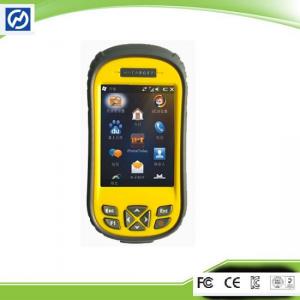
Ordnance Survey Datum GIS Data Collection for Power Line Inspection With Windows Mobile 6.5 you may upload necessary utilities or software on your Qmi...
Add to Cart

UAV Mapping Drone Foldable Multifunctional Surveying and mapping UAV Drone With RTK HD Xcam /Multispectral Camera Xmission is an industry application-...
Add to Cart

LSBM-100 Surveying and Mapping Laser Ranging Module Product Introduction The LSBM-100 Surveying and Mapping Laser Ranging Module is an excellent choic...
Add to Cart
HX4HFW460 VTOL 3D 4D Urban Modeling Surveying Aerial Mapping Drone Fully Automatic Driving Fixed Wing UAV Camera Oil-powered fixed-wing UAV Features D...
Add to Cart
Sub-centimeter Precision RTK Surveying And Mapping Base And Rover Equipment Main Specification: Satellite Signal Tracked Simultaneously 220 Channels G...
Add to Cart
SMbus communication protocol smart battery 7.4 Volt 3500mAh Surveying and mapping Battery for Trimble Survey Instruments We can make any customized ba...
Add to Cart
FOIF DSZ2 Optical transit surveying and mapping instrument Auto Level For tunnel construction of engineering survey Overview Error 1mm Magnification 3...
Add to Cart
Compact and Light Weight Inertial Imu Sensor Product Description The 16488HA inertial measurement unit is a complete inertial system with a built-in t...
Add to Cart
Bridge Surveying Mobile Mapping Solution HESAI Mechanical LiDAR Geosun gAirHawk Series GS-130X LiDAR Scanning System gAirHawk GS-130X is a kind of sho...
Add to Cart
WT-11-RK Advanced Dual-Frequency RTK Algorithm GPS Module For High Accuracy Overview Application: ● Base station, power, communication positioning fie...
Add to Cart
Product Description: The Surveying Instrument is a highly advanced and precise tool designed for professional surveyors and engineers. With a measure ...
Add to Cart
UAV LiDAR Scanning System Geosun GS-100C+ Livox Avia Topographic Surveying And Mapping Solution 5-Power supply Power supply for galvo head and control...
Add to Cart
4G LTD GPS AGPS Portable Data Terminal Barcode Scanner for Surveying and mapping SPECIFICATION DETAILS KT50 Barcode RFID Reader OS Android 5.1 Hardwar...
Add to Cart
The CP25 is a newly launched pure electric vertical take-off and landing fixed-wing UAV by CP UAV. It is based on long endurance, large load capacity,...
Add to Cart
Other attributes Material Plastic Operator Skill Level Expert Control Type Remote Control image transmission distance 15KM Maximum Flight Time 45 min ...
Add to Cart
Small Electric Fixed Wing Piloted Aircraft System Short Range Survey Mapping Solution Description Small electric < 7kg MTOW Fixed Wing (FW) Remotel...
Add to Cart
450m/650m/1200m above water range 360°×100° FoV 15cm@100m accuracy iAqua LiDAR mobile mapping system for reef survey The traditional topographic surve...
Add to Cart
Magnetic Survey Instruments Transient Electromagnetic Equipment Magnetic survey instruments are used in a variety of applications, including mineral e...
Add to Cart
Camera Drone Five-eye Tilt Photogrammetry Camera 24 Megapixel Tilt Five Camera for Land Survey Mapping Description Equipped with five high-pixel multi...
Add to Cart
3d Digital Compass Orientation Sensor Surveying And Mapping Antenna North Search ▶ MAIN FEATURE ★ Heading Accuracy: 0.5° ★ Roll Measure Range:±180° ★ ...
Add to Cart