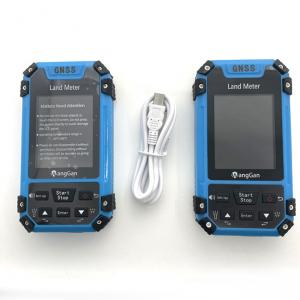
... as far as possible,set the width of the front-end operation of agricultural ry,and then carry out back and forth work measurement. ① At the...
Add to Cart
1" / 2" IMAGE Total Station Instrument Survey And Construction 3 Million Pixel Specifications GTS342I DISTANCE MEASURING Max. Distance prisms set 5KM ...
Add to Cart
30 / 50 / 100 / 150 / 200 / 300 / 500m Water Level Geophysical Survey Equipment Product Description Water level gauges are a key water management tool...
Add to Cart
Nikon AC-2S Auto Level The economical, compact and lightweight AC-2S automatic level features a built-in compensator with magnetic damper that automat...
Add to Cart
Surveying Equipment SOUTH Total Station NTS-362R8LNB Automatic Total Station Product Description New ranging system, longer range, faster speed, the s...
Add to Cart
...used for the general and exploration of metal and non-metallic solid minerals. In addition, it can also be used for engineering geological e...
Add to Cart
General Survey Core Exploration Drilling Machine For Sampling Description: General Survey Core Exploration Drilling Machine is a shallow ho sale drill...
Add to Cart
... Environmental Soil Geotechnical Engineering Investigation; Environmental Soil ; Agricultural Soil Drilling MDT...
Add to Cart
Environmental and Geotechnical Portable Diamond Drilling For Soil Sampling Surveys Environmental and Geotechnical Portable Diamond Drilling For Soil S...
Add to Cart
BACKPACK CORE RIG Core surface drilling core drilling rig 1. This portable rig is designed for mineral exploration, oil field survey, geological resea...
Add to Cart
FOIF EL302A Digital Level Surveying Instrument For Height Measurement 0.7mm Accuracy Model: EL302A Specifications: Brand FOIF Model EL302A Accuracy El...
Add to Cart
Main Application: Building base, roadbed and foundation engineering detection Cavity survey, cavern survey Quaternary overburden layer delamination Fo...
Add to Cart
... Product Description GYQ-200, GYQ-200A, and GYQ-200B are all suitable for industrial and civil construction, as well as engineering geologic...
Add to Cart
BACKPACK CORE RIG Core surface drilling core drilling rig 1. This portable rig is designed for mineral exploration, oil field survey, geological resea...
Add to Cart
UAV LiDAR Scanning System Geosun GS-100C+ Livox Avia Topographic Surveying And Mapping Solution 5-Power supply Power supply for galvo head and control...
Add to Cart
... instruments GNSS Features: Lemo FNG 7pin male plug with lanyard 0B size, also 1B 2B 3B avalaible Application: instruments GNSS Housin...
Add to Cart
... GPS Module GNSS Module Product descriptions from the supplier Overview Application: ● Location of base stations, power and communications ● ...
Add to Cart
... mono-crystalline silicon and the poly-crystalline silicon cell pieces. Through stimulates the solar spectrum lamp-house, carries on the testing an...
Add to Cart
25mm Laser diameter gauge for wire & cable high precision extruding machines wire diameter measuring equipments survey Application Apply to online det...
Add to Cart
... for PCB LED Installation Unicomp will provide installation and calibration service at the customers location Installation includes assistan...
Add to Cart

