
Add to Cart
1500m long range 5mm@50m high precision operation from -40℃to +60℃ PM-1500 Airborne LiDAR System for emergency mapping
Emergency surveying and mapping is the basic support of providing geographic information and modern surveying and mapping technology for all kinds of public emergencies. It is an important part of the national emergency response system and the guarantee and basis for command decision-making, rescue and disaster relief. The core task of emergency mapping is to provide efficient and current mapping results such as maps, basic geographic information data and public geographic information service platform for national emergencies, and carry out remote sensing monitoring, navigation and positioning, map making and other technical services as needed.
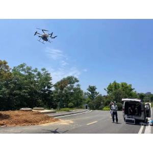
The PM-1500 airborne LiDAR system can quickly provide a wide range of terrain data in the target area for emergencies. With the Fenghu VTOL fixed wing UAV as the carrier, PM-1500 airborne LiDAR system can quickly deploy and take off on site, and can collect 3D laser point cloud in the target area. Through the later data calculation, the on-site DEM, DOM, DSM and other data can be produced rapidly for relevant departments to make command decisions and formulate effective countermeasures.
Advantages:
1. 2,000,000 points/s high point frequency: ultra high point density, capable for complex operations, suitable for electric power/forestry/modeling and other scenarios
2. 1500m long measurement range: easy processing of high drop terrain data, improve operation efficiency
3. Multi-echo technology: 4 times multi-echo, penetrate the surface vegetation gap, feedback the real terrain distribution
4. -40°C~+60°C temperature range: operation in extreme environment, face to the challenge
5. Real time point cloud: real time feedback, control on-site operation, enable emergency decision making
6. Whole process software: one-stop data processing, realize more possibilities
7. 5mm@50m high range accuracy: meet the requirements of various high-precision application scenarios
Parameters:
| Laser Scanner | Wave Band | Near Infrared (Class 1 ) |
| PRR | 100-2000kHz | |
| Maximal Measurement Range | 1000m@20%reflectivity 1500m@60%reflectivity | |
| Range Accuracy | 5mm | |
| Angular Resolution | 0.001° | |
| Scanning Speed | 40-400scans/sec | |
| FoV | 75° | |
Camera | Resolution | 42.4M pixels |
| Focal length | 28mm | |
| POS (Post-Processing) | Positioning Accuracy | Horizontal 0.01m |
| Elevation0.02m | ||
| Orientation Accuracy | Heading 0.009° | |
| Pitch/roll 0.005° | ||
| System performance | Dimension | 293×165×164mm |
Absolute Accuracy | Horizontal ≤5cm | |
| Vertical ≤5cm | ||
| Weight | 4.4 kg | |
| Multi-echo Technology | 4 times | |
| Temperature/Humidity | Operation:-40°C ~ 60°C Humidity 85% | |
Storage: -45°C ~ 70°C Humidity 85% |


