
Add to Cart
Lightweight 4.4kg 1500m Airborne LiDAR System PM-1500 5mm@50m accuracy 2000kHz high frequency for precision agriculture
Precision agriculture is an agriculture in which the required amount of chemical fertilizer, water and pesticide is calculated carefully in order to save raw material investment, reduce production cost, improve land yield and facilitate environmental protection. Its important feature is that the use of various raw materials is very accurate, and the production can be carried out in a process, so as to realize large-scale operation. Precision agriculture integrates high and new technologies such as 3S. Based on the development of information science, it is a new agricultural technology revolution with Geographic Information System (GIS), Global Positioning System (GPS), Remote Sensing technology (RS), computer automatic control system, network sampling technology, yield monitor, variable ratio generator (VRA) and crop simulation model as the core technologies.
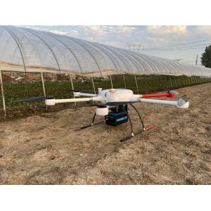
Through PM-1500 Airborne LiDAR system, the 3D point cloud information of ground crops can be effectively obtained, and then the ground and crops can be separated by point cloud filtering algorithm. Based on the specific algorithm, it can realize the automatic analysis of crop height and growth, and provide accurate guidance for fertilization, irrigation and other maintenance work.
Advantages
1. The ultra long ranging of 1500 meters greatly ensures the operation safety and improves the efficiency.
2. The super high frequency of up to 2 million points/s can more truly reflect the landform of the survey area.
3. High precision is the core demand in the field of survey and mapping, 5mm@50m accuracy meets various high-precision application scenarios.
4. PM-1500 airborne LiDAR system applies multi echo technology, the laser pulse can penetrate the vegetation gap to obtain the terrain information.
5. The overall structure of PM-1500 airborne LiDAR system has been innovatively optimized, sensors as laser scanner, camera, IMU, GPS are highly integrated.
Parameters
Items | Indicators | Parameters |
| Laser Scanner | Wave Band | Near Infrared (Class 1 ) |
| PRR | 100-2000Khz | |
| Maximum Measurement Range | 1000m@20% | |
| 1500m@60% | ||
| Range Accuracy | 5mm@50m | |
| Angular Resolution | 0.001° | |
| Scan Speed | 40-400 scans/s | |
| FoV | 75° | |
POS System | Position Accuracy(post-processing) | Horizontal 0.01m |
| Elevation 0.02m | ||
Orientation Accuracy(post-processing) | Heading 0.009° | |
| Pitch/Roll 0.005° | ||
| Camera | Camera Resolution | 42.4MP |
| Focal Length | 28mm | |
| System Performance | Dimension | 293×165×164mm |
| Absolute Accuracy | horizontal <5cm | |
| vertical <5cm | ||
| Weight | 4.4kg | |
| Multi Echo | 4 times | |
| Temperature and Humidity | Operation: -40℃~60℃, Humidity 85% | |
| Storage: -45℃~70℃, Humidity 85% |


