
Add to Cart
Pulse-based 650m range 5mm@40m accuracy 360°*100° HS650i 3D laser scanner for ecological restoration of abandoned mine
While promoting the development of human society, mineral resources destroy the ecological environment of mining area, affect the geological environment and produce serious environmental pollution. Firstly, a large number of mining surfaces, dangerous rocks and slag piles are formed in the mining process, which destroy the original vegetation of the mining area, lead to surface exposure, desertification, dust pollution, landslides and debris flow and other geological disasters. Secondly, the living environment of animals and plants is destroyed, which intensifies the habitat disturbance of animals and plants and causes the loss of diversity of plants and animals in abandoned mines. Finally, the contaminated area will be gradually expanded through water pollution, soil pollution and various degrees of solid pollution.
With the advantages of fast acquisition, high density, high precision, non-contact and wide range, 3D laser scanning technology makes up for the shortcomings of traditional measurement in data acquisition and calculation. It has achieved good results in tree factor investigation, mine surface area calculation, hidden danger analysis of mine system of landslide and dangerous rock, as well as structural safety evaluation, disaster prevention and reduction. It is more and more used in mine restoration.
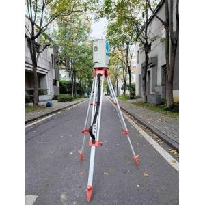
HS650i high-precision 3D laser scanner is a pulsed, full waveform, high-precision and high-frequency 3D laser scanner independently developed by Hi-Cloud. Through its high-speed laser scanning measurement method, it can quickly obtain the 3D coordinates of the surface of the measured object in a large area, with high resolution, extract and obtain the 3D real scene data of hazard sources, and calculate the surface area of bare slope, quantifying the crack characteristic line on the surface of dangerous rock to provide reliable data support for the later deformation analysis of dangerous rock, the selection of ecological treatment methods and budget of exposed palisades and dangerous rock, and greatly reduces the difficulties and inconvenience caused by manual measurement.
Advantages:
1. Measurement range from 1.5m to 650m
2. High-precision: 5mm@40m accuracy
3. Multiple intelligent registration methods are optional
4. Fully independent intellectual property rights, upgrade is guaranteed
5. The maximum measurement frequency is 500,000 points/s
Parameters:
Type | HS650i | |
| Laser Class | Class 1 (eye safe) | |
| Laser Beam Divergence | 0.35mrad | |
| Echo Mode | Full waveform, multi-echo technology | |
| Measurement Range | 1.5m to 650m@90%,100kHz | |
| Range Accuracy | 5mm@40m | |
| Laser Pulse Repetition Rate PRR | Max. 500kHz | |
| Scan FoV | vertical | 100°(-40°~+60°) |
| horizontal | 360° | |
| Angular Measurement Resolution | vertical | 0.001° |
| horizontal | 0.001° | |
| Scan Speed | vertical | 3-150scans/s |
| horizontal | max.36°/s | |
| Dual-axis tilt sensor | Range | ±5° |
| Resolution | 0.001° | |
| Data Storage | 240GB(SSD) | |
| Data Transmission | GigE/USB2.0 | |
| Control Mode | Support mobile terminal APP and remote control | |
| Communicate Interface | GigE/USB2.0/WLAN/Camera Trigger/GPS Synchronization,etc. | |
| Operation Temperature | -20℃~+60℃ | |
| Storage Temperature | -40℃~+85℃ | |
| Humidity | non condensing | |
| Protection Class | IP64 | |
| Main Dimensions | φ188mm×318mm | |
| Weight | ca.10.5Kg | |


