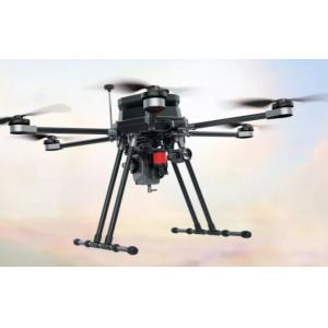
Drone Foldable Six Rotor Oil Electricity Hybrid drone XQL12 Series Foldable Six Rotor Oil Electricity Hybrid drone...
Add to Cart
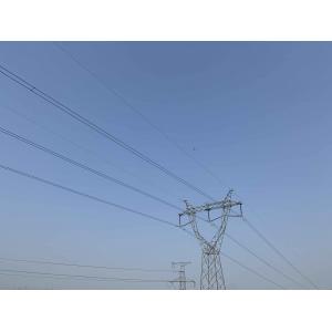
Power Line Inspection Aerial LiDAR Drone Colored Point Cloud High Accuracy Geosun gAirHawk Series GS-260X LiDAR Scanning Syste...
Add to Cart

M.03 Electric The M.03 is a high-performance electric brushless motor-powered VTOL fixed-wing unmanned aerial vehicle, engineered for Land...
Add to Cart
20KM 30KM LOS HDMI SDI Mini COFDM Transmitter for drone Description: HMMIT04 mini transmitter only weights 107g and it supports more than ...
Add to Cart
4S 14.8V 5000mAh 50C LiPo Battery - 74Wh Long-Range Drone Battery for Aerial Photography, Heavy Lift & Mapping UAVs, Airline Safe (<100Wh) Features Optimized for Maximum Flight Time: The 5000mAh capacity provides a significant boost in operational duration......
Add to Cart
... for surveying, , surveillance and inspection. At the same time, HXN1-B is a type of multi-rotor . With its 90-minute battery life, centi...
Add to Cart
Mini full duplex wireless Data Link digital Radio Compatible with Pixhawk System Introduction FIM-2430 TDD_COFDM is our new mini pure digi...
Add to Cart
5mm@50m accuracy and 1500m long range integrated System PM-1500 with 2 million points/s high frequency PM-1500 System, based o...
Add to Cart
... Video Data Link Mavlink 1080P for Drone 30km Fixed Wing Data Link Support Pixhawk High Definition Multimedia Interface Vido Input T...
Add to Cart
2.4G 5.8G UAV Aerial Photography Map Transmission Drone Receiver Antenna 5G 5.8G UAV aerial photography map transmission mapping model aerial data tra...
Add to Cart
... data collection • Construction & Terrain Engineering Inspection: Capture high-precision ground texture for earthwork measurement and site terrain ...
Add to Cart
... PCBs for Aerial Photography & Surveillance: Our PCB is built for the industry’s tough demands, delivering top-tier precision, quality and r...
Add to Cart
... surveillance, , and search and rescue missions where quick and accurate data transmission is necessary. The Data Link offers a variety ...
Add to Cart
... Surveying Product features: Light, high strength, excellent fatigue strength, strong pulling, Low noise Precise dynamic-static balance...
Add to Cart
Q20 Logistics Drone Heavy Cargo Aircraft Long Endurance UAV 1. Payload: up to 4 loads can be loaded at the same time. 2. Communication: Wide range of ...
Add to Cart
.... We provide 24 hours online technique support. We can customize the drone according to the application and client's requirements. Our Main Sol...
Add to Cart
... (LWIR uncooled) and laser rangefinder, mainly used in airborne imaging detection, recognition, tracking and ranging and positioning. etc, meet the...
Add to Cart
... and fixed-wing RC aircraft. 1. Product Overview This HGB high-rate LCO LiPo battery is designed for FPV freestyle drones, long-range quadcopter...
Add to Cart
30 inch Carbon Fiber Propeller for uav mapping drone and uav agriculture propeller Specifications Size 30*95 Length 760mm Widest point 70mm High gloss...
Add to Cart
... VTOL is an innovative Aerial Quadcopter Drone that combines the efficiency of vertical take-off and landing (VTOL) technology with the versatil...
Add to Cart