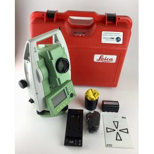
Leica TS06 total station road 2D registration code product name 2D registration code brand Leica model TS06...
Add to Cart

... and fare calculating. The product has been widely used in many agricultural activities for its creative handheld design and high performance and p...
Add to Cart

...tem, and Intelligent Calibration , HTS-360R improves the speed and distance of measurement efficiently. Using STM32 architecture and high-g...
Add to Cart
...Camera 24 Megapixel Tilt Five Camera for Mapping Description Equipped with five high-pixel multi-angle tilt photography lenses, it can ...
Add to Cart
...GPS RTK Module GPS Module GNSS Module Product descriptions from the supplier Overview Application: ● Location of base stations, power a...
Add to Cart
... Kit with UHF 430-470 MHz TRx and Product Highlights Uses all 6 GNSS systems 240 channels Integrated 3.5G cellular modem Optional U...
Add to Cart
2.5kg 330m@80% range 15mm @150m range accuracy ARS-200 High Precision Airborne LiDAR Survey with 5 times echoes ARS-200 high precision airborne LiDAR ...
Add to Cart
... 1.4Hours Endurance UAV Camera 3D Mining Urban Modeling Aerial Mapping Drone ⇨Foldable Body The flexible and flexible design of the ...
Add to Cart
Data Acquisition System 20W 1.92km2 Triple Echo Livox Avia Laser Sensor UAV LiDAR System UAV LiDAR Scanning System with Triple Echo Liv...
Add to Cart
NLOS Long distance monitor video link for vehicles/armoured vehicle Introduction ST9520CZH Digital NLOS transmitter is of high power, high...
Add to Cart
Rugged and reliable: 1. IP67, withstands a 3-meter natural fall onto concrete 2. Rapid tracking and optimum avoidance or reduction of obstruction and ...
Add to Cart
Multiple Area Measure Mode Digital 1000meter Laser Rangefinder for FEATURES ● Min/max measurement ● Continuous measurement ● Stake-out fun...
Add to Cart
Land Surveying Equipment, GPS/Gnss Receivers, Mapping Lithium Ion Battery Lithium Battery 11.1V 6600mAh Pack We can make any customized battery for or...
Add to Cart
Grip and Slide Control Prism Pole Tripods Silver Color Heavy Duty Tripods 1.2m-1.8m Model: PTS ......
Add to Cart
G9 GNSS 372 channels RTK receiver with e-survey software receive GPS/GlONASS/GALILEO/Beidou singals Specifications Signal Tracking 372 channels Advanc...
Add to Cart
SOUTH Total Station Surveying Equipment Best Price Automatic Total Station SOUTH Total Station NTS-332R10 Instrument Model NTS-332R10 Distance Measure...
Add to Cart
Key attributes Other attributes Place of Origin China Warranty 1 year Customized support OEM Brand Name FOIF channel 1408/800/394/336/555 Channels GPS...
Add to Cart
... of cargo handling operation; Stowage and lashing/securing ; Assist to ship's and freight agents at place of discharge-load-ports in accorda...
Add to Cart
AEROPAK 500ML bean green Marking Spray Paint for with MSDS certificate Brand AEROPAK CAS No. Mixture Filled ML 500ml Color bean green Item...
Add to Cart