GS-100V UAV LiDAR System 360 Degree Fov Laser Sensor Colored Point Cloud Free Software

Brand Name:Geosun
Certification:CE,ISO
Model Number:GS-100V UAV LiDAR Scanning System
Minimum Order Quantity:1
Delivery Time:10-15 works days
Payment Terms:T/T
Contact Now

Add to Cart

Verified Supplier
Location: Wuhan Hubei China
Address: 4F, Building D, Tianyi plaza No.8 West Maodianshan Road, East Lake Hi-tech Zone Wuhan City, China
Supplier`s last login times: within 24 hours
Product Details Company Profile
Product Details

Aerial Mapping GS-100V UAV LiDAR Scanning System 360 Degree Fov Laser Sensor Colored Point Cloud Free Software


Geosun gAirHawk LiDAR Scanning System GS-100V

gAirHawk GS-100V is a kind of short-range, compact LiDAR point cloud data acquisition system, integrated HESAI XT16 laser scanner, GNSS and IMU positioning and attitude determination system, and storage control unit, is able to real-time, dynamically, massively collect high-precision point cloud data and rich image information. It is widely used in the acquisition of 3D spatial information in surveying, electricity, forestry, agriculture, land planning. GS-100V LiDAR Scanning System Brochure.pdf


Specification of UAV LiDAR Scanning System gAirHawk GS-100V

UAV LiDAR Scanning System gAirHawk GS-100V


Item Name

System Parameters


GS-100V

Parameters

Weight

1.4kg

Measuring accuracy

Less than 0.1m @100m

Working temperature

-20℃~55℃

Power range

12V- 24V

Consumption

20W

Carrying Platform

Drone and Vehicle

Storage

64GB storage, maximum support 128GB TF card

Lidar Unit


Measuring Range

80m@10% Reflectivity, max range 120m

Laser class

905nm Class1 (IEC 60825-1:2014)

Channel

16-Channel

Range accuracy

±1cm (typical Value)

Scanning frequency

10HZ, 20HZ

data

Double echo 640,000 Points/Sec

FOV

360°, adjustable

Laser sensor

HESAI XT16

POS Unit

Update frequency

200HZ

Heading accuracy

0.040°

Pitch accuracy

0.015°

Rolling accuracy

0.015°

Position accuracy

≤0.05m

GNSS signal type

GPSL1/L2/L5 GLONASSL1/L2 BDS B1/B2/B3 GAL E1/E5a/5b

Pre-processing software

POS software

Output information: position, speed, attitude

Point cloud software

Output point cloud data format: LAS format, custom TXT format

Camera (built-in)

Trigger Event

Distance or Time trigger

Effective Pixel

26 Mega Pixel & 83 Degree FOV


Application of UAV LiDAR Scanning System gAirHawk GS-100V

GS-100V LiDAR and GS-850 UAV in the United States, based on high-quality LAS data, using PCA4.2 software for point cloud post-processing, single wood segmentation, point cloud automatic classification, DEM production.


Free Trial Software UAV LiDAR Scanning System gAirHawk GS-100V

Free trial test, achieve high precision

The Guideline of LiDAR Usage and Reference.pdf

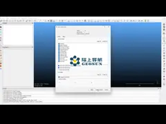
Point Cloud Pre-Processing Software Integrated With Trajectory Processing----Geosun Self-developed gAirHawk 5.0
Key Features of gAirHawk 5.0 Software
1. Raw data: intelligently load
2. Four default coordinates
3. Point cloud Optimization
4. Start and stop calculation


Package of UAV LiDAR Scanning System gAirHawk GS-100V

UAV LiDAR Scanning System gAirHawk GS-100V packed by suit case with EVA material liner inside, then covered by hard carton box. It is suitable for air shipment and sea shipment.


China GS-100V UAV LiDAR System 360 Degree Fov Laser Sensor Colored Point Cloud Free Software supplier

GS-100V UAV LiDAR System 360 Degree Fov Laser Sensor Colored Point Cloud Free Software

Inquiry Cart 0