Multi Platform Highly Integrated UAV LiDAR System ARS-1000 920m Range Scanning

Brand Name:Hi-Cloud
Certification:ISO, others upon the requests
Model Number:ARS-1000 UAV LiDAR System
Minimum Order Quantity:1
Delivery Time:10 working days
Payment Terms:T/T
Contact Now

Add to Cart

Active Member
Location: Wuhan Hubei China
Address: Building 19, East Dist. R&D Center,#27 Yangqiaohu Ave.,Jiangxia Dist.,Wuhan,Hubei,China
Supplier`s last login times: within 21 hours
Product Details Company Profile
Product Details

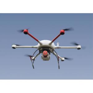
Multi platform highly integrated UAV LiDAR system ARS-1000 with long range of 920m and 15mm@150m accuracy


ARS-1000 UAV LiDAR system integrates sensors such as high-precision laser, high-definition camera, GPS, MEMS inertial navigation and storage control unit. It is a Riegl LiDAR based system which developed and built by Hi-Cloud, which can synchronously obtain 3D laser point cloud, POS data and image data. It supports base station free operation mode, through the equipped data processing and application software, quickly generates result as DSM, DEM, DOM and DLG.


Based on the advantages of light weight, convenient transportation and high efficiency of results processing, the system is widely used in the application fields such as emergency mapping, topographic mapping, power line inspection, highway survey, coastal reef survey, excavation and filling calculation, archaeological survey and mapping and so on.


Specifications of ARS-1000 UAV LiDAR System

  • Maximum Measurement Range: 920m @60%
  • Minimum Measurement Range: 5m
  • Range Accuracy: 15mm @150m
  • Repetition Accuracy: 10mm @150m
  • Max. Effective Point Frequency: 500000 points/s
  • Laser Gear for Adjustment: 6 levels
  • Maximum number of received echoes: 4~15
  • FoV(selectable): 0~330° (60°~90°airborne mode)
  • Scan Frequency(selectable): 10~200 scans/s
  • Angular Resolution: 0.001°

  • Position Accuracy(post-processing): Horizontal 0.01m / Elevation 0.02m
  • Orientation Accuracy(post-processing): Heading 0.010° / Pitch/Roll 0.005°

  • Camera Resolution: ≥42.4MP
  • Camera Weight: <500g

  • Laser Class: Class1(eye safe)
  • Absolute Accuracy: horizontal <5cm / vertical <5cm
  • Weight: 4.5kg
  • Storage: 1TB SSD
  • Input Voltage: 20~30V
  • Power Consumption: <75W
  • Operation Temperature: -10℃~+40℃
  • Storage Environment: -20℃~+50℃ / Humidity < 85%

Main Advantages of the ARS-1000 UAV LiDAR System


  • The ARS-1000 UAV LiDAR system adopts an integrated hardware platform architecture, which integrates the 3D laser scanning sensor, inertial navigation system and GPS into the platform architecture. The smaller volume and weight make the equipment easy to carry and install.
  • The embedded integrated platform makes the system more powerful and stable, and improves the system accuracy.
  • With the wireless control mode of the mobile terminal, the operation state of the system can be monitored remotely, so that the operators can get the operation situation at any time.
  • The system can adapt to various carrier platforms, such as multi rotor UAV and VTOL fixed wing UAV. In addition, it also can adapt to various operation modes such as vehicle mounted and backpack mode.
  • Under the condition of 60% reflectivity of ground objects, the system can have a maximum measurement range of 920m. Taking the airborne platform as an example, the higher the ranging, the higher the UAV can climb, the larger the measurement area, and the more point cloud data will be collected.

Highway survey project of the ARS-1000 UAV LiDAR System

Project Overview:

The terrain of the survey area is complex, the vegetation is lush and the altitude difference is large. Two highways need to be measured, with a total length of about 60km.

Project requirement and difficulties:

Be responsible for the vertical and horizontal section measurement of 100 meters (200 meters of bandwidth) on both sides of the middle line of the road according to the relevant standards, technical specifications and procedures, and the output results shall be in accordance with the 1:500 mapping requirements.

Due to the high mountains, rough roads, lush vegetation and dense traffic on the highway, the task of field survey is dangerous.

Project solution:

According to the specific situation of the project, ARS-1000 system is adopted to collect flight data along the road according to the relative altitude of 200m.

China Multi Platform Highly Integrated UAV LiDAR System ARS-1000 920m Range Scanning supplier

Multi Platform Highly Integrated UAV LiDAR System ARS-1000 920m Range Scanning

Inquiry Cart 0