
Add to Cart
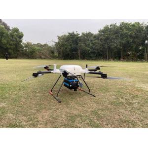
5mm@50m high accuracy 1500m long range 75° FoV PM-1500 high frequency airborne LiDAR system for forest resource survey
Traditional precise monitoring of small area of forest resources mainly uses DBH, portable altimeter, tape measure and other tools to carry out manual sampling survey on tree height, DBH, canopy area and other stand parameters. However, using traditional methods to manage and survey forest resources is laborious, time-consuming, labor-intensive, and difficult to effectively ensure the objectivity. Currently popular photogrammetry methods can only provide detailed information of horizontal distribution, and it is difficult to obtain forest vertical structure parameters. Airborne laser LiDAR can effectively compensate for the lack of information in vertical direction because of the "penetrating" characteristic of laser beam.
Through the forest point cloud data obtained by airborne LiDAR PM-1500, the 3D structure information of trees can be easily obtained. The point cloud data can be filtered to separate tree points from ground points, and then the tree point cloud data can be processed separately to extract the key stand parameter information of stand canopy density, plant number and tree height. The airborne LiDAR system based on PM-1500 has the characteristics of high precision, high efficiency and strong objectivity, which can meet the needs of forest resources survey.
Advantages
1. 2M points/s ultra high frequency, unlock more application scenarios
2. 1500m ultra long range, regardless of high drop terrain
3. Supports 4 times echo, feedback real terrain
5. 5mm@50m high accuracy for fine results
6. Stable and reliable system with high level of integration
Parameters
Items | Indicators | Parameters |
| Laser Scanner | Wave Band | Near Infrared (Class 1 ) |
| PRR | 100-2000Khz | |
| Max. Range | 1500m@60% reflectivity | |
| Range Accuracy | 5mm@50m | |
| Angular Resolution | 0.001° | |
| Scan Speed | 40-400 scans/s | |
| FoV | 75° | |
| Camera | Camera Resolution | 42.4MP |
| Focal Length | 28mm | |
| POS System | Position Accuracy(post-processing) | Horizontal 0.01m |
| Elevation 0.02m | ||
| Orientation Accuracy(post-processing) | Heading 0.009° | |
| Pitch/Roll 0.005° | ||
| System Performance | Dimension | 293×165×164mm |
| Weight | 4.4kg | |
| Absolute Accuracy | <5cm | |
| Multi Echo | 4 times echo | |
| Temperature and Humidity | Operation: -40℃~60℃, Humidity 85% | |
| Storage: -45℃~70℃, Humidity 85% |


