Product Details
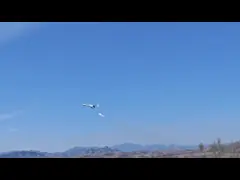
Drone V88 with Camera EIS Hand Control Foldable Quadcopter Optical
Flow UAV
Description
Precision Agriculture UAVs (Unmanned Aerial Vehicles), also known
as drones, are unmanned aircraft equipped with specialized sensors
and imaging technologies used for precision agriculture
applications. These UAVs are specifically designed to gather data
and provide valuable insights for optimizing agricultural practices
and improving crop yields
Specification
| Product model | V88 | Product size | 26*23.5*5.5cm(unfolded size)
12*8*5.5cm(folded size) |
| Product name | 2.4G fixed height aerial photography drone | Storage bag package size | 21*6*15cm |
| Body color | Black, gray | Storage bag full set weight | 332g |
| Body battery | 3.7V 1800 mah lithium battery | Color box package size | 22.2 * 6.7 * 17.5 cm |
| Remote control battery | Battery size 3 by 5 (not included) | Color box full set weight | 413g |
| Flight time | About 10 minutes | Battery weight | 21g |
| Charging time | 60 minutes | Number of boxes | 36pcs |
| Remote control distance | 150m | Outer box specifications | Storage bag outer box 66*26.5*50cm color box outer box 46*42.5*55cm |
| Figure transmission distance | 30m | Gross net weight of outer box | 15.5/14 kg |
| No camera feature | Fixed height function, aircraft foldable, six-pass band gyroscope;
One button take off, one button land, rise and fall, forward and
backward, left and right side fly, turn, headless mode, fuselage
light/headlight |
| With camera function | Fixed height function, aircraft foldable, six-pass band gyroscope;
One-button take off, one-button land, rise and fall, forward and
backward, left and right side flight, steering, headless mode, body
light/headlight (with camera can be added: gesture photography,
video, headless mode, emergency stop, trajectory flight, gravity
sensing, music, 50x zoom, automatic photography) |
| Accessories | Aircraft *1 Remote Transmitter *1 Body battery *1 Spare blade set
of USB cables *1 Screwdriver *1 Instruction manual *1 Built-in HD
camera *1 WIFI instruction manual *1 |
Features
- Multispectral and Hyperspectral Sensors: Precision Agriculture UAVs
are equipped with multispectral or hyperspectral sensors that
capture data in multiple bands of the electromagnetic spectrum.
These sensors can detect various wavelengths of light, providing
information about plant health, nutrient levels, moisture content,
and stress indicators.
- High-Resolution Cameras: These UAVs are equipped with
high-resolution cameras capable of capturing detailed aerial images
of agricultural fields. The images provide farmers with a visual
representation of the crop health, growth patterns, and potential
issues such as pests, diseases, or weed infestations.
- Global Positioning System (GPS): Precision Agriculture UAVs are
integrated with GPS technology, enabling precise positioning and
accurate georeferencing of the collected data. This allows for the
creation of detailed field maps and the accurate identification of
specific areas requiring attention or treatment.
- Data Processing and Analysis Software: The collected data from
Precision Agriculture UAVs is processed and analyzed using
specialized software tools. These software tools help farmers and
agronomists interpret the data, generate actionable insights, and
make informed decisions about crop management strategies.
Applications
- Crop Health Monitoring: Precision Agriculture UAVs are used to
monitor and assess the health of crops throughout the growing
season. The aerial imagery and sensor data captured by the UAVs
provide valuable information about plant stress, nutrient
deficiencies, and disease outbreaks. This information helps farmers
to implement targeted interventions and optimize the use of
fertilizers and pesticides.
- Yield Prediction: By analyzing the data collected by Precision
Agriculture UAVs, farmers can estimate crop yields accurately. This
information enables better planning for harvesting, storage, and
marketing activities, leading to improved profitability and
resource management.
- Irrigation Management: Precision Agriculture UAVs assist in
optimizing irrigation practices by providing insights into soil
moisture levels and water distribution patterns. By identifying
areas with inadequate or excessive moisture, farmers can make
informed decisions about when, where, and how much water to apply,
resulting in efficient water usage and reduced water waste.
FAQ:
- Q: What is the Model Number of Aerial Photography UAV?
- A: The Model Number of Aerial Photography UAV is M8.
- Q: Where is Aerial Photography UAV produced?
- A: Aerial Photography UAV is produced in China.
- Q: What is the minimum order quantity of Aerial Photography UAV?
- A: The minimum order quantity of Aerial Photography UAV is 1 Pcs.
- Q: What is the price of Aerial Photography UAV?
- A: The price of Aerial Photography UAV is negotiable.
- Q: What is the packaging details of Aerial Photography UAV?
- A: The packaging details of Aerial Photography UAV is standard
packages.
- Q: What is the delivery time of Aerial Photography UAV?
- A: The delivery time of Aerial Photography UAV is 3-7 work days.
- Q: What are the payment terms of Aerial Photography UAV?
- A: The payment terms of Aerial Photography UAV are L/C, D/A, D/P,
T/T, Western Union.
- Q: How many pieces of Aerial Photography UAV can be supplied per
month?
- A: We can supply up to 100,000 pieces of Aerial Photography UAV per
month.
Company Profile
Hong Kong Global Intelligence Technology Group Limited is a
high-tech enterprise integrating R&D, production, and sales of
military, police, and civilian drones.
In response to national strategies and calls, and to cope with
fluctuations in the foreign political environment, Hong Kong Global
Intelligence Technology Group and its subsidiaries jointly
participated in the strategic planning of the intelligent industry
development of government projects and carried out the construction
of new economic and industrial infrastructure, taking the
construction of low-altitude economic industrial parks as the core
is to focus on new models and new business formats of the drone
industry, promote military-civilian integration, and develop and
support military.