Add to Cart
This Pro Thermal Imaging Drone is perfect for Army use, it is also applicable for fire rescue, power patrol, engineering, etc.
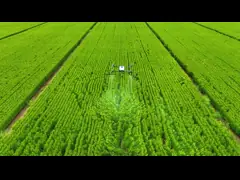
The ZAi-M300 Thermal Imaging UAV sets a new standard in aerial solutions. It comes equipped with a advanced dual sensor, allowing for seamless transitions between visible light and thermal imaging. Capable of carrying payloads up to 3kg, the thermal drone delivers an impressive 10km flight range and maintains operation for up to 40 minutes. Crucially, its three-axis gimbal provides superior stability, ensuring all your captured images and videos are remarkably clear and smooth. This model has the following selling points:
1. Infrared thermal imaging camera: The imaging system of the drone adopts a new image processing algorithm to make the details of thermal imaging clearer and clearer and easier to observe distant targets.
2. Strong flight performance: carbon fiber texture body,10000mAh battery, this drone is durable, lightweight, bringing higher operating efficiency.
3. Full load strength, Go forward: The drone can mount load modules such as photoelectric pod, lighting lamp, caller, harmful gas monitoring, etc
4. Dual optical channel: visible day and night, less affected by weather and light, this UAV can be observed day and night
5. Folding design, lightweight: can be put into a backpack or suitcase, the drone can be deployed and taken off within 1 minute, shooting anytime
| Item | Specifications |
|---|---|
| Key Words | Thermal imaging bomb-carrying drone |
Flight time | 40mins(no load),16mins(full load) |
Maximum distance | 1080P 10km |
Satellite Positioning Systems | GPS/GLONASS |
Flight control | Compatible with Mavlink protocol flight control |
Stabilization | 3-axis(pitch,roll,course) |
| Camera sensor | 1/3.02"CMOS,8mp |
Image Resolution | 8mp |
Video Resolution | 2.7K,25 FPS |
Thermal imaging infrared camera sensor | Vanadium oxide uncooled infrared focal plane detector |
Effective measurement distance | 150m |
| charger input voltage | AC110v-240v (provide accordingly) |
Charge time | < 2 hours |
| Working time | 2-4 hours |
1. Drones are prohibited from flying in the following areas: key sensitive units and areas of Party and government agencies, military-controlled areas, hazardous chemical storage, large material reserves, prisons, power stations, etc.
2. Densely populated areas: large event venues, stations, docks,
squares, parks, business districts, schools, hospitals
hospital etc.
3. Airport no-fly zone
1) Basic Customization: flight duration, image transmission distance, load capacity
2) Function Customization: Software & Hardware (Automatic obstacle avoidance, precise landing, drone parachute, drug-free alarm, low voltage alarm, dustproof and waterproof, loss of control return, intelligent identification, digital graphics control, effective distance, automatic tracking, tethered base station power supply, image control-free, centimeter-level and accuracy, etc.