Add to Cart
Thermal Imaging Payload Drone: Advanced UAV for Tactical Missions
The Thermal Imaging Payload Drone is a state-of-the-art unmanned
aerial vehicle (UAV) engineered for multifaceted operational
demands, with a core emphasis on high-precision thermal imaging and
tactical payload deployment. Designed for battlefield resilience,
this system integrates cutting-edge technology to deliver unmatched
situational awareness and mission-critical performance.
Dual-Light Gimbal System
Seamlessly combines a visible light camera and a thermal imaging camera, enabling real-time multispectral data capture for comprehensive environmental analysis.
Foldable, lightweight airframe with military-grade durability, optimized for rapid deployment in harsh conditions.
Mavlink Protocol Integration
Advanced flight control system compatible with the Mavlink protocol, ensuring precise maneuverability, stable communication, and seamless integration with existing military command platforms.
High-Performance Thermal Imaging
Sensor: Vanadium oxide (VOx) uncooled infrared focal plane detector.
Resolution: 256×192 pixels.
Temperature Measurement:
Accuracy: ±2°C or ±2% (whichever is greater).
Range:
Industrial applications: -15°C to 150°C.
Biological detection: 30°C to 42°C.
Effective Detection Range: Up to 150 meters for human targets.
| Drone Parameter | Value |
|---|---|
| Product Name | M100 4G Module Drone |
| Maximum Ascend Speed | 5m/s |
| Maximum Decsend Speed | 4m/s |
| Battery | 10000mAh |
| Wheelbase | 500mm, foldable |
| 4G Extended Image Transmission | Global 4G Image Transmission, Unlimited Distance |
| Max Service Ceiling Above Sea Level | 5000m |
| Flight Control | Compatible With Mavlink Protocol Flight Control |
| Satellite Positioning Systems | GPS/GLONASS |
| Flight Time | 40mins(no Load),29mins(Full Load) |
| Maximum Flight Speed | 16m/s (GPS mode) |
| Stabilization System | three-axis mechanical gimbal (pitch, roll, yaw) |
1,Advanced Thermal Imaging Technology
2,Modular Multi-Function System
3,3Full-Stack Customization
3-Axis Brushless Motor Stabilization Gimbal
4,MAVLink Protocol Integration
5,High-Energy-Density Power System
6,3kg Tactical Payload Capacity
The Remote Control Drone ZAi-M100 is an unmanned aerial vehicle (UAV) that has been designed to be remotely operated.
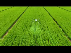
The Thermal Imaging Payload Drone finds extensive practical applications across various societal domains. In emergency response, it aids in search and rescue operations by swiftly locating missing persons or survivors in disaster-stricken areas, even in low-visibility conditions. In agriculture, it assists farmers in monitoring crop health, identifying irrigation issues, and assessing the effectiveness of pest control measures through thermal imaging of vegetation. Furthermore, in law enforcement, the drone enhances capabilities by detecting and tracking suspects or criminal activities during nighttime operations, thereby augmenting public safety efforts. Overall, its ability to provide real-time thermal imaging data facilitates critical decision-making processes in emergency response, agriculture, law enforcement, and numerous other societal contexts.