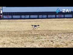
ZAi Faith Mini 2 GPS Drone With Professional 4K HD Camera
Professional 4K Aerials, No Registration Needed!
Weighing less than 250g, the ZAi Faith Mini 2 GPS Drone is your
go-anywhere drone. Its 3-axis brushless motor gimbal ensures
incredibly stable 4K/2.7K HD video. Benefit from precise
GPS/GLONASS & optical flow positioning, a 4000m range, and
33-minute flight time. Smart features like One Key Shot, Follow Me,
and Waypoint simplify complex shots, while intelligent return
functions (One Key, Low Battery, Lose Control) provide peace of
mind. Stay connected with 5G WiFi and future-proof with OTA
upgrades (4G support).
Key Features
- Ultra-Portable & Registration-Free: Weighing under 250g, it avoids common drone registration
requirements, making this foldable drone ideal for travel and
spontaneous flights.
- Professional Stabilization: 3-axis brushless motor gimbal ensures your 4K/2.7K HD videos are
incredibly smooth and stable, even in dynamic conditions.
- Precise Positioning: Rock-solid stability and control with GPS/GLONASS and optical flow
positioning systems.
- Extended Range & Flight Time: 4000m flight distance and up to 33 minutes of flight time on a
single charge.
- Intelligent Flight Modes: One Key Shot, Follow Me, and Waypoint flight for cinematic shots
with ease.
- Enhanced Safety Features: One Key Return, Low Battery Return, and Lose Control Return for
safe operation.
- Seamless Connectivity: 5G WiFi for live video transmission with OTA (Over-The-Air)
upgrades including 4G support.
Technical Specifications
| Parameter | Description |
|---|
| Satellite Positioning Systems | GPS / GLONASS |
| Wheelbase | 600mm, foldable |
| Battery | 2100mAh |
| Maximum Distance | 1080P 10km |
| Gimbal | 3-axis |
| Operating Temperature Range | -5-40℃ |
| Maximum Ascend Speed | 5m/s |
| Max Service Ceiling Above Sea Level | 5000m |
| Photo Format | JPEG |
| Flight Time | 26mins |
| Application | Remotely Operated UAV, Unmanned Aerial Vehicles, Drones High
Resolution |
Applications
The Faith Mini 2 GPS Drone is a revolutionary 3D view drone with
high-resolution imaging capabilities (3840*2160 JPEG photos) and
dual GPS/GLONASS satellite positioning. Ideal for various
applications with its wide operating temperature range (-5 to 40℃)
and 26-minute flight time.
Customization Options
Available for Geographic Information System Drones, Topographical
Drones, and 3D Mapping Drones. Customization options include
software/hardware modifications, logo branding, and packaging.
Minimum order quantity starts at 1 piece with negotiable pricing.
Frequently Asked Questions
Q: Are you a manufacturer or trade company?
A: We are the manufacturer.
Q: Do you accept customization?
A: Yes, we accept customization both on software & hardware and
logo branding, color boxes, as well as packaging.
Q: What is your warranty policy?
A: One-year warranty, replacement, or repair services shall be
provided under non-artificial quality issues.
Q: What's your MOQ?
A: Our MOQ is 1000pcs, trial orders, and samples are also
available.
Q: Where are the drones shipped from?
A: We send drones from our Shenzhen factory, or we can send them
from Vietnam and the Philippines.