Add to Cart
product description:
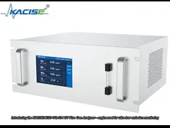
KsINS-02 is an airborne inertial visual navigation product. It is mainly composed of inertial navigation, visible light camera, infrared camera, AI data processing circuit, etc. Based on the principles of optical imaging and inertial measurement, it provides the UAV with inertial/visual combined attitude, Speed, position information, angular velocity, acceleration and other information. This product introduces artificial intelligence technology, which has brought revolutionary changes to the field of image and video recognition in recent years, into the field of drone navigation. Through the fusion of inertial/machine vision multi-information, it achieves high-precision real-time measurement of aircraft motion parameters without relying on satellites. Under such circumstances, it provides a complete solution for autonomous guidance and navigation of the entire mission profile of aircraft taking off, cruising, and landing.
Features:
● Provide autonomous navigation information for the entire mission profile of UAV take-off, cruise and landing
● Autonomous recognition of airport runways all day and night based on AI, adaptable to emergency landings at unfamiliar airports
● Front view and downward view can be installed flexibly and can be expanded to receive image information of loads such as pods.
● Suitable for Gobi, desert, mountain, city and other scenes
● Does not rely on satellites and dedicated pre-made maps
Product advantages:
● Integrated design of imaging and navigation
● Strong adaptability to the airborne environment
● High-precision inertial/visual information fusion
● Visible light and infrared images are fused and output as SDI standard video
● Target detection results are displayed in real time
Application fields and application modes:
It has been successfully used in many types of drones .
Performance indicators :
| take off | Cruise section | Take-off and landing section | |
| Action range | Before leaving the ground | 1km~8km (relative altitude) | The forward distance is 5km~ Stop (the runway width is not less than 45m) |
Navigation accuracy | 1.0m(1σ,lateral accuracy) | 20m+1%H (1σ, horizontal positioning accuracy,H is the height of the aircraft relative to the ground) | 1.0m+1‰ D (1σ, lateral accuracy, D is horizontal distance between the aircraft and the runway endpoint) |
Application environment :
| Operating temperature | -40℃ ~+60℃ | |
| Storage temperature | -45℃ ~+65℃ | |
| System preparation | static base alignment, Alignment time 5 minutes | |
| field of view | visible light | 57.80°×34.50° |
| infrared | 35.83°×27.26° | |
Physical properties:
| Length×width×height | 179mm×140mm×126mm |
| weight | ≤ 2.0kg |
| Front view installation dimensions | 10-M3×8mm threaded hole |
| Installation dimensions as viewed from below | 4-M4×8mm threaded hole |
External Interface:
| powered by | 28V, adjustable range 24V~36V | ||
| Power consumption | ≤ 40W | ||
Electrical Interface | user connector | F104Z19K092-140, realizing power supply and communication | |
| Debug connector | F104Z19K086-240, realize software upgrade | ||
| 2-way standard SMA connector | 1920×1080@30Hz format SDI video output | ||
Communication Interface | RS422 serial port | Inertial navigation information input | 200Hz |
| RS422 serial port | Flight control command input | 5Hz | |
| Inertial/visual integrated navigation information output | 100Hz | ||
Xi'an Kacise is certified by ISO 9001-2008, GJB 9001B-2009, CE,
intrinsic safety explosion-proof and isolated safety
explosion-proof, etc. which assure our products are conform to the
international standards.
We have been specializing in manufacturing pressure, level and flow
measuring instruments and related products for 10 years. We have
experienced technical and management personnel, through the efforts
of our entire staff, we have become a professional measuring
instrument manufacturer and solution provider.
Currently, Kacise sensor is already exported to America, Spain,
Australia, Chile and 20 other countries and regions, and received
many favorable feedbacks. Our overseas distributers are also
increasing.
We supply high quality Turbine Gas Flow Meter, hope we can
coopperate in near future by providing you suitable products, good
services and reasonable prices.