GLPix-RTK Autopilot+RTK+30Km Radio(Transmitter and Receiver ) integrated Unit Special Designed Ready for Mapping Drone
Brand Name:GL
Certification:CE,ISO,ROHS
Model Number:GLPix-RTK
Minimum Order Quantity:1Set
Payment Terms:T/T
Place of Origin:CHINA
Contact Now
Add to Cart
Site Member
Location:
Hong kong Hong kong China
Address:
A105 1/F, New East Sun Industrial Building, 18 Shing Yip Street, Kwun Tong, Kowloon, HK.
Supplier`s last login times:
within 18 hours
Shipping
lt's easy to get a shipping quote! Just click the button below and complete the short form.
Get Shipping Quote
Product Details
Company Profile
Product Details
GLPix-RTK Autopilot+RTK+Radio(Transmitter and Receiver ) integrated Unit Special Designed Ready for Mapping Drone
GLPix-RTK is a high accurate,industrial grade integrated RTK and Autopilot control system which is special designed for fixed wing drones,multicopters,UAV helicopter and high accurate mapping applications.The system integrated improved PixHawk, high performance center process,centimeter-level accuracy GPS receiver and national standard digital radio,support autonomous flight and radius 30-50km remote control distance. It has strong electromagnetism anti-interference,highly reliable.
Brief Introduction:
- Based on improved industrial grade PixHawk autopilot
- Built-in centimeter-level accuracy RTK-GPS receiver
- Support pix4 firmware and QGroundControl GCS,APM firmware and Mission Planner GCS
- 8-Channel Main PWM output interface,6-Channel auxiliary output interface
- 1-Channel PPM/SBUS input interface,1-Channel RSSI input interface
- Universal out interface,compatible with any GPS receiver module,external compass,air-speed and other access equipments
- Customized designed for external interface,adopted J30 series or LEMO series connectors
- Equipped with National Standard Remote Control Digital Radio(30-50KM Radius)
- Equipped with built-in battery,including digital radio ground terminal and RTK-GPS base equipment,convenient for outside tasks
- All access interfaces with EletroStatic Protection ,power supply interface with over-current protection and over-voltage protection
- Support Control-Loss protection,multi-flight modes,Terrain Tracking ,2Axle gimbal and 3Axle gimbal control
- Support camera automatic shooting, SD card record flight datas and centimeter-level accuracy POS datas,equip National Standard 1W digital radio with remote control:30km-50km distance
Electric Parameters:
Power Supply: PixHawk :DC5-5.5V input ; Supply module :DC6-60V input, DC 5.3V output
Ground Equipment:DC5-5.5V input,inner 5200mah battery
Power Dissipation: PixHawk:<3W Ground Equipment:<5W
Physical Parameters:
Dimension: PixHawk 90*50*26mm Ground Equipment 160*80*35mm
Weight:
PixHawk: 100g Ground Equipment:300g
Ambient:
Storage Temperature:-55°—+85° Application Temperature:-25°—+65°
Techical Datas:
Update Frequency:400Hz
GPS Frequency:10Hz
Position Accuracy: Single Point 0.5m
RTK:0.008m
Max Flight Height: 12000m
Max Flight Speed:511m/s
System Start Time:<30s
RTK Ready Time:<60s
GLPix-RTK autopilot Access Interface Definition:
- All PWM,PPM,SBUS Interface adopt 2.54 Pin Header,easy to connect with receiver,servos,esc and so on
- All equipments interface adopt horizontal Pin Molex1.25 socket,interface definition compatible with the origin PixHawk interface
Packing List:
- GLPix-RTK ( Alloy Shell)— PixHawk autopilot and RTK Integrated 1 Piece
- Onboard digital radio(Optional Frequency: 433Mhz,840Mhz,915Mhz,2.4GHz) 1 Piece
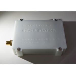
- Ground Equipment(Alloy Shell-Built-in digital radio transmitter,RTK-GPS base,) 1 Piece
- Digital Radio Antennas : 2 Pieces
- Onboard GPS light Antenna: 1 Piece
- Base RTK-GPS Antenna: 1 Piece
- TNC convert SMA RF adaptor: 1Piece
- SMA Coaxial Cable(50cm,100cm or tailored for you) 2Pieces
www.uavgl.com

GLPix-RTK Autopilot+RTK+30Km Radio(Transmitter and Receiver ) integrated Unit Special Designed Ready for Mapping Drone
Inquiry Cart
0