China Categories
English
Home /Sports & Entertainment /Golf /

map drawing software

1 - 10 Results for map drawing software from 1569 Products

Outdoor Waterproof 3D Projection Mapping Software Interactive Wall Projector

China Outdoor Waterproof 3D Projection Mapping Software Interactive Wall Projector on sale
Item Name: Outdoor building 3D mapping projection ProductModel: NL-5000LmW, NL-6000LmW,NL-7500LmW, NL-8500LmW,NL-10000LmW, NL-15000LmW,NL-20000LmW Power Supply: 100~240V AC(50/60Hz) Lumens: Depends on the model (5000-20000 Lumens) Resolution Ratio: Depends......
Northern Lights (Guangzhou) Digital Technology Co.,Ltd
Verified Supplier
Unit A 101,Building 3C,Huachuangll,HuatengRoad,Panyu District,Guangzhou City,China

Stamping Lathes EDM Machined Parts Natural Color With CAD Drawing Software

China Stamping Lathes EDM Machined Parts Natural Color With CAD Drawing Software on sale
Natural Color Stamping Lathes EDM Machine Parts With CAD Drawing Software Direct Distribution EDM Machine Parts Custom Color By Precision Grinding Machine Product Information: Product Name Direct Distribution EDM Machine Parts Custom Color By Precision ......
Dongguan Sheng Rui Precision Mould Co., Ltd.
Verified Supplier
No.5, Yutian South Road,ShuTian Community, Humen Town,Dongguan City, China.

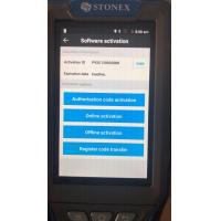
Land Surevy Software China brand CHC GNSS RKT Landstare software registration code

China Land Surevy Software China brand CHC GNSS RKT Landstare software registration code on sale
...Software China brand CHC GNSS RKT Landstare software registration code SurPad4.0 is a GNSS surveying and mapping software which is developed by the Geoelectron company. Based on years of accumulating market experience, in com- bination with the international mainstream of surveying and mapping data acquisi- tion function of the software......
Shanghai Hengyide Electronic Technology Co.,Ltd Ltd.
Verified Supplier
Rm.306-308,No.5 Building,Jinglian Road 439#,Minhang District,Shanghai,China

Forestry 3D Mapping HESAI XT32 Senor UAV LiDAR GS-260X Colored Point Cloud Free Pre-Processing software High Accuracy

China Forestry 3D Mapping HESAI XT32 Senor UAV LiDAR GS-260X Colored Point Cloud Free Pre-Processing software High Accuracy on sale
Forestry 3D Mapping HESAI XT32 Senor UAV LiDAR GS-260X Colored Point Cloud Free Pre-Processing software High Accuracy UAV LiDAR Scanning System GS-260X integrates Hesai XT32 laser sensor and all built-in units to create a ......
Wuhan Geosun Navigation Technology Co., Ltd.
Verified Supplier
4F, Building D, Tianyi plaza No.8 West Maodianshan Road, East Lake Hi-tech Zone Wuhan City, China

THINKCAR Thinkdiag Full-System OBD2 TOPDON Phoenix Plus Integrated Bi-Directional Diagnostic Tool Topology Mapping ECU Coding (incl. Diagnostic Tool Multi-Brand Coverage 1-Year Free Software Updates

China THINKCAR Thinkdiag Full-System OBD2 TOPDON Phoenix Plus Integrated Bi-Directional Diagnostic Tool Topology Mapping ECU Coding (incl. Diagnostic Tool Multi-Brand Coverage 1-Year Free Software Updates on sale
[Second Hand US Ship] TOPDON Phoenix Plus Integrated Diagnostic Tool Bi-Directional Control Topology Mapping 41 Maintenance Services ECU Coding VAG [Second Hand US Ship] TOPDON Phoenix Plus Integrated Diagnostic Tool Bi-Directional Control Topology Mapping......
JIU TECH Enterprise Co., Ltd
Verified Supplier
No.16 Building, Tongfu Industrial Park, Nanshan District, Shenzhen, China.

Disposable Eyebrow Measuring Ruler For Quick Mapping Shaping

China Disposable Eyebrow Measuring Ruler For Quick Mapping Shaping on sale
...? Look no further than the Wintape Disposable Draw Eyebrow Ruler, the ultimate guide for quick and easy eyebrow mapping and shaping. This unique measuring tape sticker is designed to help you create perfectly symmetrical eyebrows every time. Whether you...
Wintape Laser Tape Measure CO.,LTD
Verified Supplier
No.1317-1418 D, 13A Floor, Building D, Wanda Plaza, Jianshe Ave. Huangqi, Nanhai, Foshan, Guangdong 528248

Web Vehicle GPS Tracking Software Windows 2008 For Fleet Easy Management

China Web Vehicle GPS Tracking Software Windows 2008 For Fleet Easy Management on sale
...Software, Platform, System For Fleet Easy Management Jointech Cloud GPS tracking software for fleet management. Jointech clould tracking software are designed as per Windows Operation System, friendly interface, easy to operate. Online GPS tracking services for your fleet of vehicles. Locate and track in real time through the web and your smartphone, from every location in the world! Features include mapping......
Shenzhen Joint Technology Co., Ltd.
Verified Supplier
Floor, T4, Hi Park, Luozu Community, Shiyan Street, Baoan District, Shenzhen, China

Android 4.2.2 Android GPS Navigation Box for JVC Unit , Free Map and Software Upgrade

China Android 4.2.2 Android GPS Navigation Box for JVC Unit , Free Map and Software Upgrade on sale
Android Box Navigtion for JVC Unit , Free Map Upgrade and Software Upgrade , Android 4.2.2 AVH-X1750DVD, AVH-X2750BT, AVH-XL4750DVD, AVH-XL4750DVD, AVH-XL5750BT, AVH-X5750, AVH-X6750DVD, AVH-X7750BT, AVH-X8750BT 2014 Models: AVH-X4000NEX, AVH-X5600BHS, AVH......
Shenzhen Xinsongxia Automobile Electron Co.,Ltd
Verified Supplier
Room401, A17 Building,Huai De Cui Gang Indutrial Park NO.4 district, Fu Yong street,Bao an district, Shenzhen city, China.

Android 12.0 WIFI Touch Screen Car Navigation For Toyota Corolla 2007 With Radio Goggle Map

China Android 12.0 WIFI Touch Screen Car Navigation For Toyota Corolla 2007 With Radio Goggle Map on sale
...; 2.can use the video player, play any video; 3.can use the music player, play any songs; 4.You can log in to Google PLAY online and download any software you need; 5.can read real-time news information; 6.Google / germin / waze / IGO map software can be...
Hunan 1-touch Intelligent Technology Co., Ltd.
Verified Supplier
601-602, Building C, Hanfu Science Park, 348 Ainan Road, Longgang District, Shenzhen City, Guangdong Province

Supports Online Cheap GIS and Mapping

China Supports Online Cheap GIS and Mapping on sale
... GIS and Mapping With Windows Mobile 6.5 you may upload necessary utilities or software on your Qmini M ,to suit your next job . You can collect GIS/GPS points and maps via the GIS application of your choice , either a third-party software such as ESRI......
Chongqing Gold Mechanical & Electrical Equipment Co.,Ltd
Nanping west road,Nanping,Chongqing
Submit “map drawing software” inquiry
*From:
Your email address is incorrect!
To:
Northern Lights (Guangzhou) Digital Technology Co.,Ltd
*Subject:
Your subject must be between 10-255 characters!
*Message:
Your message must be between 20-3,000 characters!
Yes! I would like your verified suppliers matching service!

This supplier has been verified by Everychina.com. Our verification process includes: 3 on-site visits by Everychina.com's service team!

Business license check OK