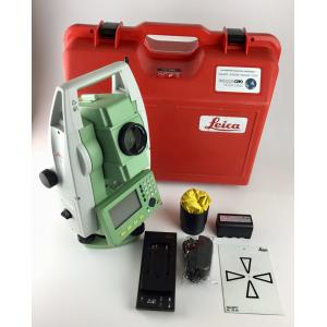
Land Survey Software Leica TS06 total station road 2D software registration code
Road Mapping High Precision Mobile LiDAR Geosun gAirHawk GS-260X
10-16 Cayenne Car Multimedia Navigation System Built-in Road Maps
Outdoor Waterproof 3D Projection Mapping Software Interactive Wall Projector
All Maps Web Based GPS Vehicle Tracking System Software Support Multi Language
Android 12.0 WIFI Touch Screen Car Navigation For Toyota Corolla 2007 With Radio Goggle Map
2024 LAUNCH X431 PRO3 10 inch Diagnostic Scanner Support Topology Map Online Coding
Web Vehicle GPS Tracking Software Windows 2008 For Fleet Easy Management
Supports Online Cheap GIS and Mapping
Ecm Titanium V1.61 18475 Driver Automotive Diagnostic Software New Version For Cars / Trucks
40-45KM UHF 1.3G/1.4GHz Mapping Drones/VTOL Video links With Easy Configuration Via Software
10 Inch Touch Screen Display For Non Road Machinery Industrial Display Screen IPad Interaction Interface 4G
ARS-200 Drone LiDAR Mapping System 2.5kg UAV Topographic Survey
Mini Otdr Machine With OPM OLS VFL RJ45 Cable / Event Map For SM 1310nm1550nm
HD 7" Width 10.8cm Truck GPS Navigators Map Sat Nav Photo Viewer
Industrial Aircraft UAV Drone MdLiDAR1000UHR For Surveillance Mapping Inspection
On sale 12 Inch Wheel 250 Watt Electric Road Scooter For Adults
Portable X Ray Airport Baggage Scanning Equipment With Intelligent Software, hand held xray screening machine