
Add to Cart
4.4kg high precision 5mm@50m long range 1500m high frequency 2000kHz PM-1500 UAV LiDAR System for road survey and design
Transportation industry is a basic industry to promote the development of national economy. It plays a very important role in production and daily life. The accurate and efficient acquisition and updating of road information is of great significance to speed up the construction of transportation infrastructure. From the initial scheme planning to the final construction drawing design, the accuracy grade and scale of survey results required in each stage of highway survey are different. Therefore, how to efficiently obtain and use high-precision and multi-scale massive information is the goal of highway survey. Compared with other measurement methods, airborne LiDAR (Light Detection and Ranging, LiDAR) technology is a technology that can continuously, automatically, quickly and efficiently obtain geospatial information with high temporal and spatial resolution. At the same time, it is suitable for forest areas and mountainous areas, which is of great help to improve the efficiency of highway survey.
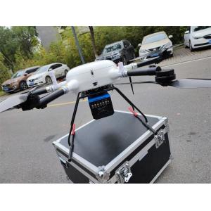
PM-1500 airborne LiDAR system mounted on the L150 multi-rotor UAV or Fenghu VTOL UAV, can scan a large area of the road line to be located, and then obtain the 3D laser point cloud data of the area. Through denoising, filtering and other operations on the point cloud data, rich data products such as topographic map of the survey area, digital ground model, vertical and horizontal section map can be obtained, so as to provide topographic map and other basic data for road survey and design.
Features
1. Multi platforms as VTOL fixed wing UAV/ multi-rotor UAV/helicopter
2. 2M points/s high frequency, unlock more application scenarios
3. 1500m long range, 75° FoV, more efficient for tasks
4. 5mm@50m accuracy, can meet various high-precision application scenarios
5. Supports 4 times echoes, feedback real terrain
6. Reliable system, highly integrated and innovatively optimized
Parameters
| Laser Scanner | Wave Band | Near Infrared (Class 1 ) |
| PRR | 100-2000kHz | |
| Range Accuracy | 5mm@50m | |
| Angular Resolution | 0.001° | |
| Max. Range | 1500m@60% | |
| Scan Speed | 40-400 scans/s | |
| FoV | 75° | |
| Camera | Camera Resolution | 42.4MP |
| Focal Length | 28mm | |
| POS System | Position Accuracy(post-processing) | Horizontal 0.01m |
| Elevation 0.02m | ||
| Orientation Accuracy(post-processing) | Heading 0.009° | |
| Pitch/Roll 0.005° | ||
| System Performance | Dimension | 293×165×164mm |
| Absolute Accuracy | horizontal <5cm | |
| vertical <5cm | ||
| Weight | 4.4kg | |
| Multi Echo | 4 times | |
| Temperature and Humidity | Operation: -40℃~60℃, Humidity 85% | |
| Storage: -45℃~70℃, Humidity 85% |


