China Categories
English
Home /Electrical Equipment & Supplies /Switches /

topographic map software

1 - 10 Results for topographic map software from 387 Products

2100mAh 3D Mapping Drones Versatile Imaging Topographic Mapping Drone

China 2100mAh 3D Mapping Drones Versatile Imaging Topographic Mapping Drone on sale
Product Description: 3D Mapping Drones are topographical-mapping-drones with geographic-information-system capabilities. Their maximum ascend speed is 5m/s and their maximum decsend speed is 4m/s. The flight control is compatible with Mavlink Protocol Flight Control, and the wheelbase is 600mm,foldable. Also, the drones are equipped with satellite positioning systems, including GPS and GLONASS, for accurate data collection. With the combination...
HONG KONG GLOBAL INTELLIGENCE TECHNOLOGY GROUP LIMITED
Verified Supplier
ROOM A1, 11/F WINNER BUILDING, 36 MAN YUE STREET, HUNG HOM, KOWLOON, HONG KONG

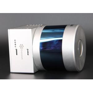
HESAI Pandar 20B Topographic Mapping UAV LiDAR System

China HESAI Pandar 20B Topographic Mapping  UAV LiDAR System on sale
gAirHawk GS-260S UAV LIDAR SCANNING SYSTEM Drone LiDAR Scanning System mounted on DJI M300 Application for Topographic Mapping gAirHawk GS-260S is a kind of Mid-range, compact LiDAR point cloud data acquisition system, integrated HESAI Pandar 40P laser scanner, GNSS and IMU positioning and attitude determination system, and storage control unit, is able to real-time, dynamically, massively collect high-precision point cloud data and rich image...
Wuhan Geosun Navigation Technology Co., Ltd
Verified Supplier
4F, Building D, Tianyi plaza No.8 West Maodianshan Road, East Lake Hi-tech Zone Wuhan City, China

Foldable 3D Mapping Drones For Topographic Mapping 3840*2160 HK-DF8166D

China Foldable 3D Mapping Drones For Topographic Mapping 3840*2160 HK-DF8166D on sale
Product Description: 3D Mapping Drones are Unmanned Aerial Vehicles (UAVs) used for Geographic Information System (GIS) and mapping purposes. These high-performance drones are capable of taking aerial photographs, creating 3D models and capturing hyper-detailed imagery. With their extended 4G image transmission, they can send and receive images from unlimited distances worldwide. Moreover, they are compatible with Mavlink Protocol Flight Control,...
HONG KONG GLOBAL INTELLIGENCE TECHNOLOGY GROUP LIMITED
Verified Supplier
ROOM A1, 11/F WINNER BUILDING, 36 MAN YUE STREET, HUNG HOM, KOWLOON, HONG KONG

Outdoor Waterproof 3D Projection Mapping Software Interactive Wall Projector

China Outdoor Waterproof 3D Projection Mapping Software Interactive Wall Projector on sale
Outdoor Waterproof 3D Projection Mapping Software Interactive Wall Projection 3D Architectural projection technology is a cutting-edge innovation in the realm of new media, standing out as the most advanced projection technology globally. By using architectural structures as its canvas and seamlessly blending real and virtual elements, it delivers an astonishing audio-visual experience to audiences at night that surpasses their wildest imaginatio...
Northern Lights (Guangzhou) Digital Technology Co.,Ltd
Verified Supplier
4th Floor, KaiDa Business Center, ShiXin Road, Panyu District, Guangzhou, China

Industrial Qualtrics Survey Tool , High Speed Running Free Mapping Software

China Industrial Qualtrics Survey Tool , High Speed Running Free Mapping Software on sale
Stonex GNSS RTK receiver controller software Surpad registration code Surveying instrument software...
Shanghai Galaxy International Trade Co.,LTD
Verified Supplier
Rm.306-308,No.5 Building,Jinglian Road 439#,Minhang District,Shanghai,China

100-2000kHz PRR PM-1500 Airborne LiDAR System For Topographic Mapping

China 100-2000kHz PRR PM-1500 Airborne LiDAR System For Topographic Mapping on sale
100-2000kHz PRR 5mm@50m accuracy 1500m range PM-1500 airborne LiDAR system for topographic mapping of complex terrain At present, the traditional topographic mapping is mostly carried out by aerial photogrammetry, which is more effective for the mapping of small-scale topographic map. Facing the operation demand of large-scale topographic mapping, especially the mountain topographic mapping with high drop and dense forest, the applicability and...
Wuhan Hi-Cloud Technology Co.,Ltd
Building 19, East Dist. R&D Center,#27 Yangqiaohu Ave.,Jiangxia Dist.,Wuhan,Hubei,China

High Accuracy 15mm@150m UAV LiDAR Sensor System ARS-1000L For Topographic Mapping

China High Accuracy 15mm@150m UAV LiDAR Sensor System ARS-1000L For Topographic Mapping on sale
High accuracy of 15mm@150m long range 1350m UAV LiDAR System ARS-1000L with high frequency of 750000 points per second Developed and built by Wuhan Hi-Cloud Technology Co.,Ltd, ARS-1000L UAV LiDAR system is a Riegl LiDAR based system with high level integration. It integrates sensors such as high-precision laser, high-definition camera, GPS, MEMS inertial navigation and storage control unit and synchronously obtains 3D laser point cloud, POS data...
Wuhan Hi-Cloud Technology Co.,Ltd
Building 19, East Dist. R&D Center,#27 Yangqiaohu Ave.,Jiangxia Dist.,Wuhan,Hubei,China

Topographical Mapping Windows CE Modern Design Total Station

China Topographical Mapping Windows CE Modern Design Total Station on sale
Topographical Mapping Windows CE Modern Design Total Station The ZTS-360/R is configured with advanced dual-axis compensatorfor auto error elimination and auto accuracy compensation,Diversified data transfer options such as SD card, USB pen drive, mini-B interface This kind of Hi-Target high precision total station is widely used in surveying and mapping,engineering construction,it's popular in the market for it's high precision,good quality...
Chongqing Gold Mechanical & Electrical Equipment Co.,Ltd
Nanping west road,Nanping,Chongqing

Windows CE Topographical Mapping New Condition Survey Equipment

China Windows CE Topographical Mapping New Condition Survey Equipment on sale
Windows CE Topographical Mapping New Condition Survey Equipment The ZTS-360/R is configured with advanced dual-axis compensatorfor auto error elimination and auto accuracy compensation,Diversified data transfer options such as SD card, USB pen drive, mini-B interface This kind of Hi-Target high precision total station is widely used in surveying and mapping,engineering construction,it's popular in the market for it's high precision,good quality...
Chongqing Gold Mechanical & Electrical Equipment Co.,Ltd
Nanping west road,Nanping,Chongqing

Hi-target Reflectorless 600m Total Stations for Topographical Mapping

China Hi-target Reflectorless 600m Total Stations for Topographical Mapping on sale
Product Introduction Hi-target GPT3502Ln Total Station Class1 Safe Pulse Laser EDM Laser Pointer for Reflectorless Measurement and Layout Point Guide for Stakeout/Layout 24-Key Alphanumeric Keyboard Versatile On board Applications Including Road Rugged IP66 Dust and Water Protection Powerful 2,000m Reflectorless EDM A refinement of GPT3502Ln Total Station advanced time-of-flight (pulse) EDM technology in the GPT-3500 allows measuring distances...
Shandong Chinacoal Group co.,ltd
no 11 xinyuan road,jining City Shandong province
Submit “topographic map software” inquiry
*From:
Your email address is incorrect!
To:
HONG KONG GLOBAL INTELLIGENCE TECHNOLOGY GROUP LIMITED
*Subject:
Your subject must be between 10-255 characters!
*Message:
Your message must be between 20-3,000 characters!
Yes! I would like your verified suppliers matching service!

This supplier has been verified by Everychina.com. Our verification process includes: 3 on-site visits by Everychina.com's service team!

Business license check OK