China Categories
English
Home /Transportation /Aircraft /

maps maps

1 - 10 Results for maps maps from 6905 Products

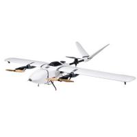
UAV Mapping Drone Nimbus V2 VTOL Long Range Fixed Wing UAV for Mapping

China UAV Mapping Drone Nimbus V2 VTOL Long Range Fixed Wing UAV for Mapping on sale
UAV Mapping Drone Nimbus V2 VTOL Long Range Fixed Wing UAV for Mapping Foxtech Nimbus VTOL V2 for Mapping and Survey-RTK/PPK Version (DA16S Combo) This Nimbus V2 can be equipped with Foxtech Map-01 and Map-A7R mapping cameras to do mapping jobs, when you use this Nimbus to do mapping, also could equipped Nimbus with RTK, and PPK system to increase the map precision. Foxtech Nimbus VTOL V2 is a cost-effective plane compared with other expensive...
Shanghai Galaxy International Trade Co.,LTD
Verified Supplier
Rm.306-308,No.5 Building,Jinglian Road 439#,Minhang District,Shanghai,China

UAV Mapping Drone Long range aerial survey fixed wing uav mapping drone

China UAV Mapping Drone Long range aerial survey fixed wing uav mapping drone on sale
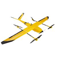
UAV Mapping Drone Long range aerial survey fixed wing uav mapping drone Long range aerial survey fixed wing uav mapping drone Material Carbon Fiber Function Public Safety Mapping Surveillance Color Customers' Demand Max payload 5kg Max takeoff weight 25kg Level speed 70 ~ 110km/h...
Shanghai Galaxy International Trade Co.,LTD
Verified Supplier
Rm.306-308,No.5 Building,Jinglian Road 439#,Minhang District,Shanghai,China

UAV Mapping Drone Foldable Six Rotor Oil Electricity Hybrid Mapping UAV drone XQL12 Series

China UAV Mapping Drone Foldable Six Rotor Oil Electricity Hybrid Mapping UAV drone XQL12 Series on sale
UAV Mapping Drone Foldable Six Rotor Oil Electricity Hybrid Mapping UAV drone XQL12 Series Foldable Six Rotor Oil Electricity Hybrid Mapping UAV drone XQL12 Series Foldable Six Rotor Oil Electricity Hybrid Mapping UAV drone XQL12 Series uses advanced gasoline engine and motor integrated power supply technology, so it has dual advantages of oil and electricity. By oil power generation, enough continuous power output is ensured, and the flexibility...
Shanghai Galaxy International Trade Co.,LTD
Verified Supplier
Rm.306-308,No.5 Building,Jinglian Road 439#,Minhang District,Shanghai,China

UAV Mapping Drone Nimbus Long Endurance VTOL UAV Drone with PPK for Precision Mapping and Survey

China UAV Mapping Drone Nimbus Long Endurance VTOL UAV Drone with PPK for Precision Mapping and Survey on sale
UAV Mapping Drone Nimbus Long Endurance VTOL UAV Drone with PPK for Precision Mapping and Survey Foxtech Nimbus VTOL V2 for Mapping and Survey(DA16 with PPK) Product Name Nimbus V2(X9D Combo) Stall Speed 10m/s to 11m/s Wingspan 1800mm Suggested Take-off Weight 4.84Kg Max Flying Height 3500m Suggested Payload 800g Max Flying Speed 35m/s Flight Duration 1-1.5 h Average Speed 15m/s to 16m/s Suggested Battery 6S 10000mah Lipo Battery (x1) Foxtech...
Shanghai Galaxy International Trade Co.,LTD
Verified Supplier
Rm.306-308,No.5 Building,Jinglian Road 439#,Minhang District,Shanghai,China

UAV Mapping Drone Foldable Multifunctional Surveying and mapping UAV Drone With RTK HD Xcam /Multispectral Camera

China UAV Mapping Drone Foldable Multifunctional Surveying and mapping UAV Drone With RTK HD Xcam /Multispectral Camera on sale
UAV Mapping Drone Foldable Multifunctional Surveying and mapping UAV Drone With RTK HD Xcam /Multispectral Camera Xmission is an industry application-level multi-functional unmanned flight system, which collects many years of technical accumulation and practical experience of Chivalrous technology in the field of unmanned aerial vehicles. Chivalrous use advanced design and manufacturing technology, easy to use, and powerful. Thanks to the...
Shanghai Galaxy International Trade Co.,LTD
Verified Supplier
Rm.306-308,No.5 Building,Jinglian Road 439#,Minhang District,Shanghai,China

UAV Mapping Drone BABY SHARK 260 VTOL Fixed Wing UAV Drone for Surveillance and Mapping

China UAV Mapping Drone BABY SHARK 260 VTOL Fixed Wing UAV Drone for Surveillance and Mapping on sale
UAV Mapping Drone BABY SHARK 260 VTOL Fixed Wing UAV Drone for Surveillance and Mapping Your Purchase Includes: RTF Combo: 1x Foxtech BABY SHARK 260 VTOL Frame 4x T-motor MN505 KV260 4x T-motor FLAME 60A ESC 2x 1655 MARKII Matte CF Propeller CW&CCW 1x 4120 KV500 1x Hobbywing 120A ESC 1x 15x8 Wooden Propeller CW 4x X10 Mini Servo 1x Px4 Air Speedometer 1x ASSAN UBEC-8A 1x Power Monitor Module 1x Pixhawk 2.1 Standard Set with Here 2 GNSS 1x DA16S+...
Shanghai Galaxy International Trade Co.,LTD
Verified Supplier
Rm.306-308,No.5 Building,Jinglian Road 439#,Minhang District,Shanghai,China

UAV Mapping Drone Trending hot products high performance low price uav mapping drone rtk

China UAV Mapping Drone Trending hot products high performance low price uav mapping drone rtk on sale
UAV Mapping Drone Trending hot products high performance low price uav mapping drone rtk Flight control type SUPERX2 GPS/RTK PRO Operating efficiency 4.0ha/h Homework at night support Automatic filling machine ALR3 Autonomous obstacle avoidance Tianmu XCope Handheld remote ARC1 Radar copy to ground 30m Smart handheld ground station A2 Imitation ground accuracy ≤0.1m Dimensions 1831x1831x472mm Positioning GNSS RTK Minimum shipping size 1190x1181x4...
Shanghai Galaxy International Trade Co.,LTD
Verified Supplier
Rm.306-308,No.5 Building,Jinglian Road 439#,Minhang District,Shanghai,China

UAV Mapping Drone Customization high quality cheap price practical uav mapping drone rtk

China UAV Mapping Drone Customization high quality cheap price practical uav mapping drone rtk on sale
UAV Mapping Drone Customization high quality cheap price practical uav mapping drone rtk Flight control type SUPERX2 GPS/RTK PRO Operating efficiency 4.0ha/h Homework at night support Automatic filling machine ALR3 Autonomous obstacle avoidance Tianmu XCope Handheld remote ARC1 Radar copy to ground 30m Smart handheld ground station A2 Imitation ground accuracy ≤0.1m Dimensions 1831x1831x472mm Positioning GNSS RTK Minimum shipping size 1190x1181x4...
Shanghai Galaxy International Trade Co.,LTD
Verified Supplier
Rm.306-308,No.5 Building,Jinglian Road 439#,Minhang District,Shanghai,China

UAV Mapping Drone Unmanned aerial vehicle uav mapping spraying drone

China UAV Mapping Drone Unmanned aerial vehicle uav mapping spraying drone on sale
UAV Mapping Drone Unmanned aerial vehicle uav mapping spraying drone Feature: 1) Working Stability, High Efficiency; 2) Remote operation, avoid pesticide poisoning; 3) Easy maintenance & use and low maintenance costs; 4) Does not have any waste gas, absolute environmental protection; 5) Small size, needn’t special landing airport, light weight and easy to carry; 6) Spray pattern can save at least 50% of pesticide use, and reduce water consumption...
Shanghai Galaxy International Trade Co.,LTD
Verified Supplier
Rm.306-308,No.5 Building,Jinglian Road 439#,Minhang District,Shanghai,China

1500m Long Range Integrated UAV Mapping System PM-1500 LiDAR Mapping Equipment

China 1500m Long Range Integrated UAV Mapping System PM-1500 LiDAR Mapping Equipment on sale
5mm@50m accuracy and 1500m long range integrated UAV Mapping System PM-1500 with 2 million points/s high frequency PM-1500 UAV Mapping System, based on a new generation of core technology framework, is a newly launched domestic airborne LiDAR with high point frequency, high line frequency, high precision and high integration. The core component of the system is the laser scanner with multi-echo technology function which is independently developed...
Wuhan Hi-Cloud Technology Co.,Ltd
Building 19, East Dist. R&D Center,#27 Yangqiaohu Ave.,Jiangxia Dist.,Wuhan,Hubei,China
Submit “maps maps” inquiry
*From:
Your email address is incorrect!
To:
Shanghai Galaxy International Trade Co.,LTD
*Subject:
Your subject must be between 10-255 characters!
*Message:
Your message must be between 20-3,000 characters!
Yes! I would like your verified suppliers matching service!

This supplier has been verified by Everychina.com. Our verification process includes: 3 on-site visits by Everychina.com's service team!

Business license check OK